Based on UER’s previous work developing a set of strategic maps and data sets for evaluation, the Maryland Environmental Trust (MET), a statewide land trust and independent unit of the Maryland Department of Natural Resources, has funded UER (through a 2017 Janice Hollmann grant) to proceed to Phase II of this important work — work which is essential for UER to finalize development of our ecosystem restoration strategy for the Maryland suburbs of the District of Columbia and begin implementation.
As part of the grant-funded work, UER will identify priorities within the data sets and maps from Phase I of this project. UER will then begin to approach landowners and communities willing to partner with UER to create, develop, and manage Eco-Functioning Spaces in areas with maximum environmental impact.
EFS in private lands located in the following areas will enable UER to magnify the collective environmental impact of large public investments in ecosystem restoration:
-
Adjacent to protected natural areas,
-
Adjacent to other lands that have already received public investments in green infrastructure, or
-
Unprotected natural areas that significantly affect environmental quality.
Grant funding from MET is provided by the Maryland State Highway Administration (SHA). We thank MET and SHA for their support and partnership.
Snapshots of the 3 interactive maps we produced as part of Phase I — with the help of Salisbury University’s Eastern Shore Regional GIS Cooperative — are shown below:
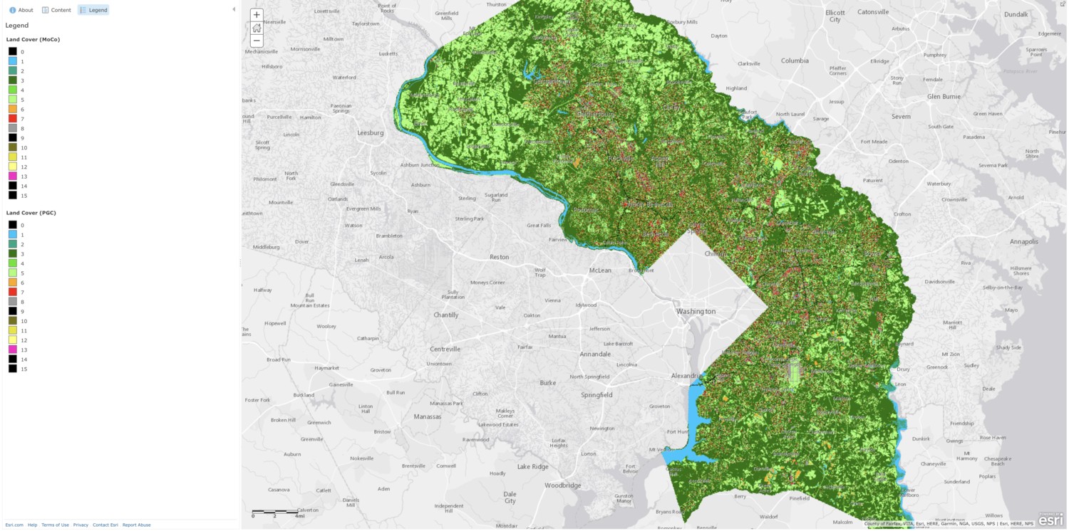
Existing conditions: eco-functioning spaces and land use
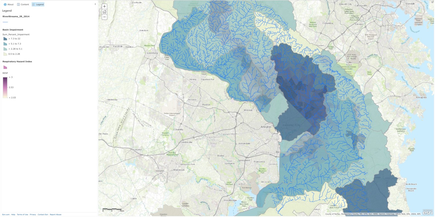
Spectrum of ecosystem function breakdown
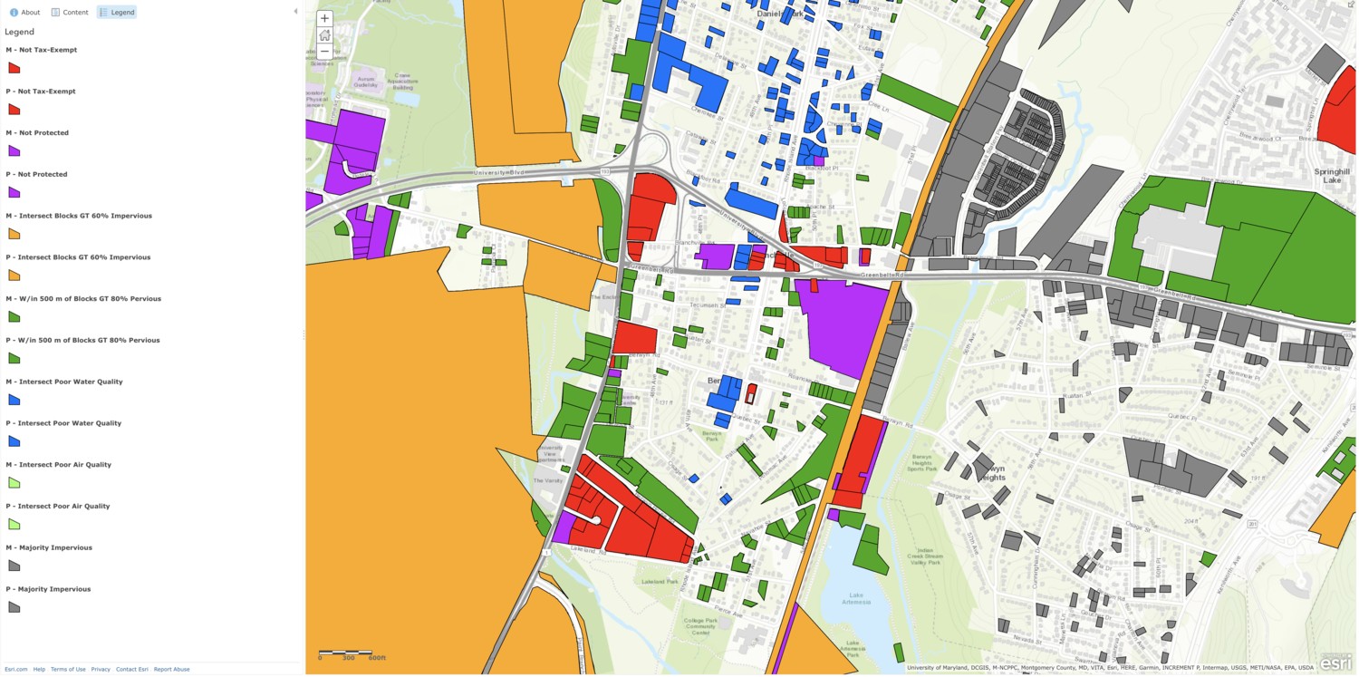
Strategic Priority Results